Huntley Quarry Geology Reserve The Huntley Quarry Geology Reserve is intended for use by people of all ages and abilities. We have prepared a basic teachers pack aimed at Key Stage 3 which con be downloaded as pdf files, using the links below. If you have any suggestions as to how this can be improved or extended for different levels of education, please do let us know. The Huntley Quarry Teacher's Pack includes: Huntley Quarry Teachers Guide [Download here]
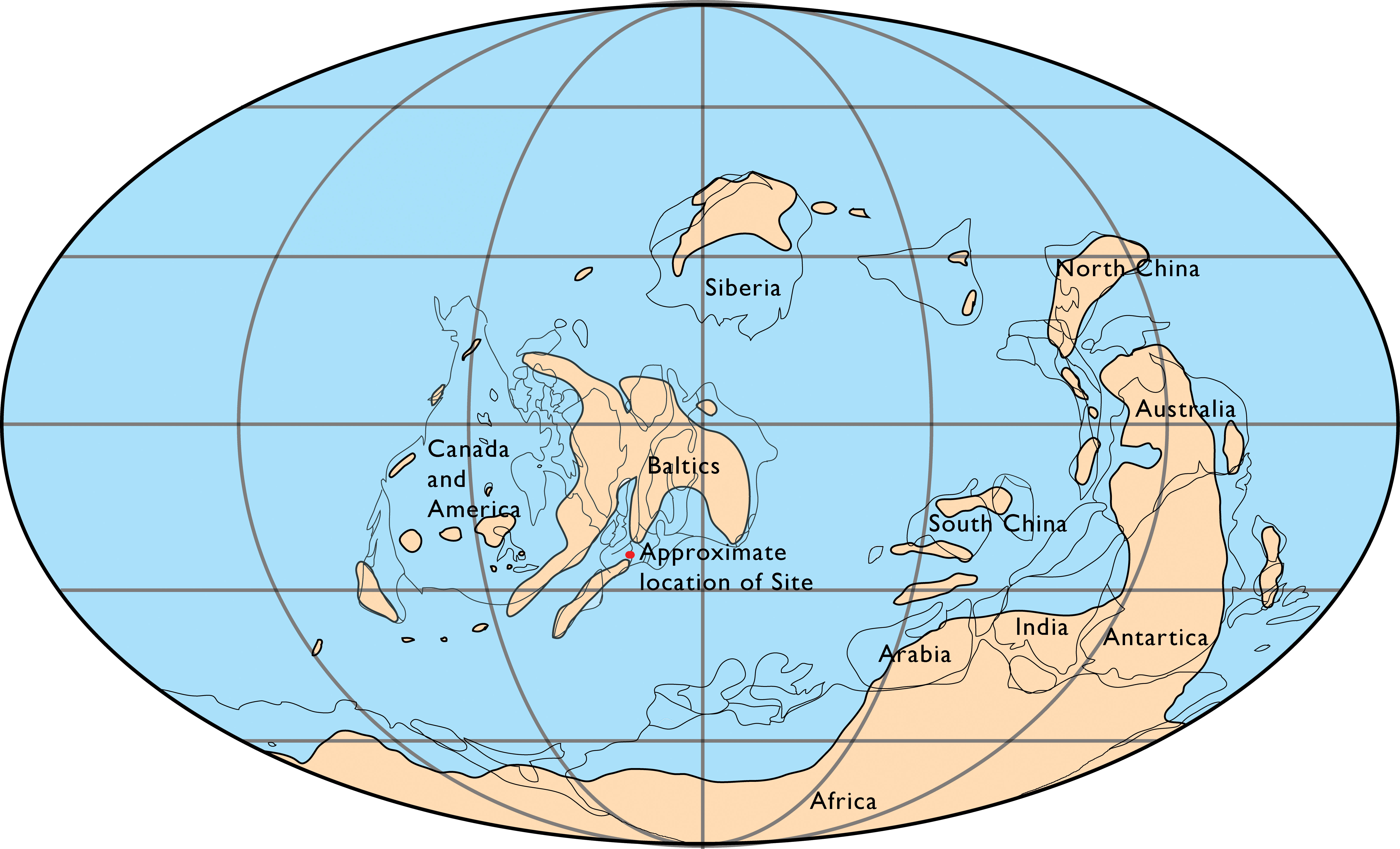
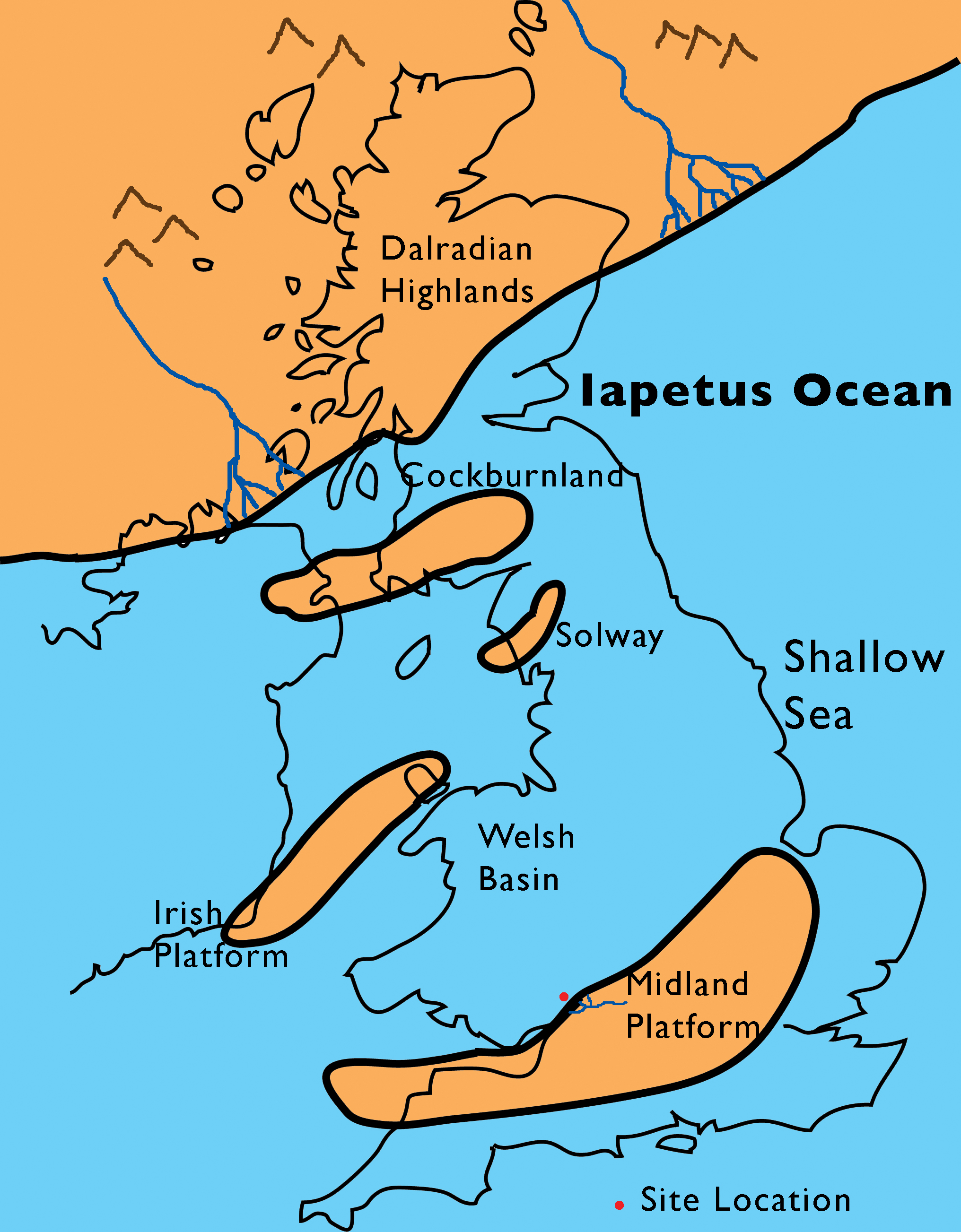
A close up of the are that is now the British Isles, shows where the land areas were, and how much of the area was
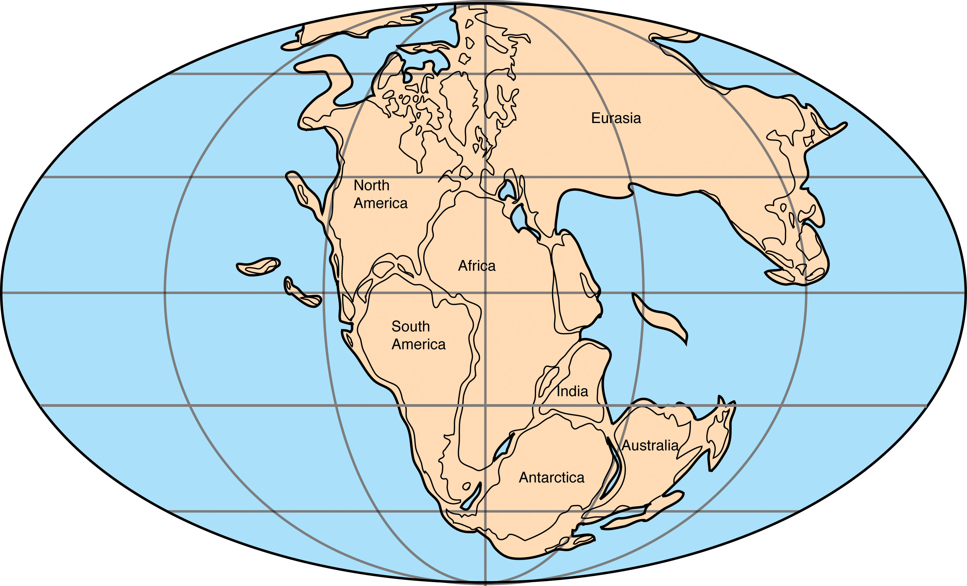
The softer mudstones on the eastern side of the Blaisdon Fault, and the sandstones in Acker's Quarry, were formed over 200 million years later during the Triassic period, by which time the continents had amalgamated into the Supercontinent of Pangaea and spread out from north to south poles (See image below).
For more information on the Huntley Quarry Geology Reserve, contact us directly, or order a Reserve Guide from our Guides and Publications page.
GGT would like to thanks our sponsors and supporters of the Huntley Quarry Geology Reserve:
|
|


| Gloucestershire Geoconservation Trust. Registered Charity Number: 1115272. © 2024 All Rights Reserved. |